Wednesday, 11 October 2023

Tinnakill Castle, Laois

 Tinnakill Castle

First and foremost my gratitude is due to the landowner who farms here for his permission to enter and photograph this Laois Tower House. 
Without his help this post would have little to no photographic record of this wonderful local antiquity which is steeped in history.

The Castle is located in a rural area somewhat midway between Mountmellick and Portarlington.

Tinnakill Castle, Laois

From what I have gathered online the Castle was once called Tynekill Castle. It is an Irish Tower House and is believed to date between the late 16th or early 17th century.

Tinnakill Castle, Laois

Having been granted to the MacDonnells circa. 1562 we can assume it had previous inhabitants who were dispossessed so presumably it's quite likely the Castle dates to a period slightly earlier than that mentioned online.

Tinnakill Castle, Laois

There was purportedly a Sheela na Gig removed from the Castle and inserted into a garden wall alongside another, possibly taken from nearby Portnahinch Church ruins. 

When enquiries were made in an effort to locate them they were both reported as destroyed with the fragments used as building material.

Tinnakill Castle, Laois

A fishy sounding story if ever there were one and quite likely nothing but Codswallop.

Tinnakill Sheela na Gigs

We will never know exactly what happened to these valuable artifacts but with less than 130 examples in the Country their loss is both unquantifiable and immeasurable.

Tinnakill Castle, Laois

Tinnakill was for most of its working life a MacDonnell Castle. 
The MacDonnells were Scottish "planters" who settled in this area.

Tinnakill Castle, Laois 

The Laois/Offaly plantation of the mid 1500's which began under Queen Mary was just one of a number of attempts to remove both the native population and "unfaithful" early settlers from the land and replace them with "planters", chiefly English, Scottish and Welsh.

Tinnakill Castle, Laois 
The "planters" were granted lands and titles by the English Monarch in order to subdue and control Ireland and reap the subsequent economic rewards. 

The plantation of Laois/Offaly proved to be a particularly successful endeavor.

Tinnakill Castle, Laois

Laois became Queen's County, named after Queen Mary I, with Maryborough, now Portlaoise, as its County seat.

Tinnakill Castle, Laois

Offaly became King's County and was named such after Mary's husband, the King of Spain, King Philip II. 
Philipstown, now Daingan, was its County seat.

Tinnakill Castle, Laois

It was strange times indeed when an Irish midlands town could logically be named after a Spanish King.

Tinnakill Castle, Laois

The MacDonnells were granted the right to the Castle on the understanding that they maintained a number of Gallowglass soldiers (9 to 12) ready for use by the Crown forces should they be requested and if requested they be "victualled" for three days.

Tinnakill Gallowglass

I have lost my original source of reference but in a twist of faith and within a generation a subsequent head of the MacDonnell Clan at Tinnakill was no longer a trusted servant of the Crown but rather a renegade with a bounty placed on his head.

MacDonnell Family Tree, Tinnakill, Laois

How quick indeed the winds of change do blow.

The Tinnakill Duanaire is an early 17th century manuscript containing 83 "bardic religious poems" and is unusual for its type in being chiefly written on Sheepskin parchment.

Tinnakill Duaraire

It was owned by the MacDonnells and in now housed in Trinity College Dublin. I have listed a link to the full manuscript at dias.ie online below.


Further Reading:


Portnahinch Church ruin, Laois

Portnahinch Church Ruin 


Located not far from the town of Mountmellick in Laois lies the small Church ruin of Portnahinch.

Portnahinch Church Ruins, Laois

Today it is quite easy to fly past on the road that runs alongside almost without even noticing its presence.

Portnahinch Church Ruins, Laois

At the present time there in confusion as to the date of its original construction and there are no early records of a Church at this site.

Portnahinch Church Ruins, Laois 

The rudimentary construction of a window opening has been taken as suggestive of the14th century however with no records before, during and after that period of a Church here for many centuries the building is also suggested as originating in the 17th century. 

Old Map of Portnahinch

This seems a more likely date for its construction.

Portnahinch Church Ruins, Laois

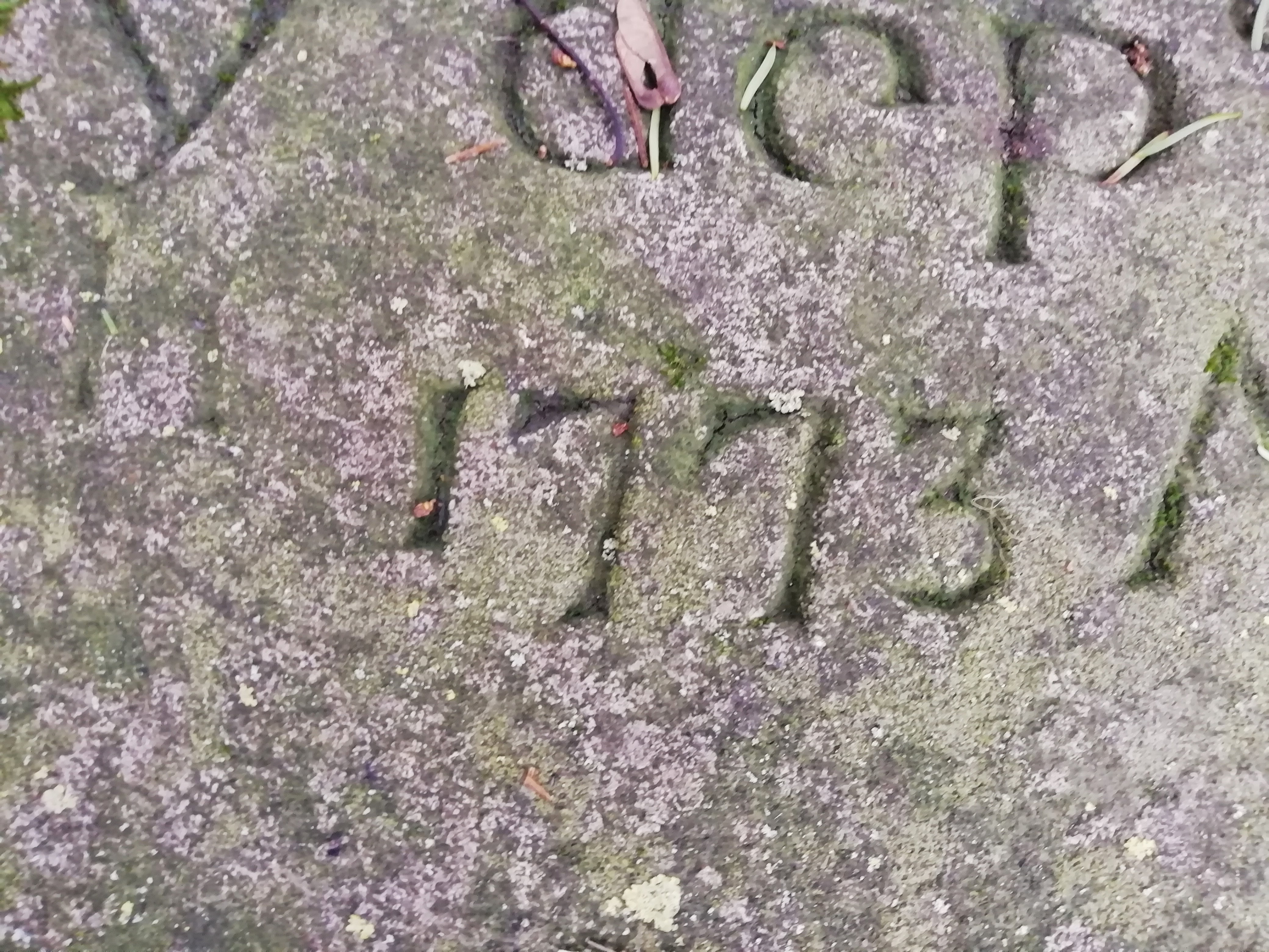
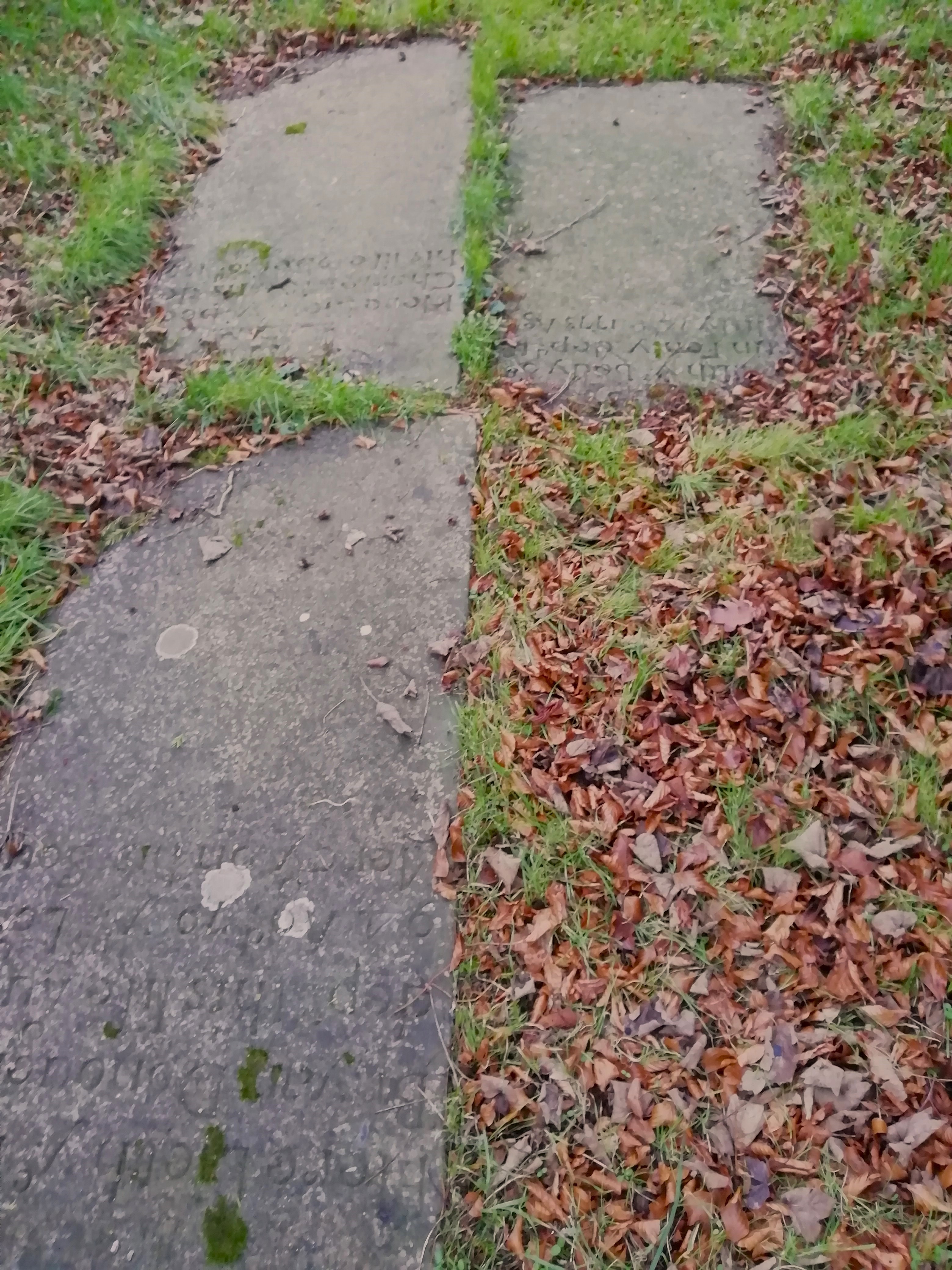
The earliest gravestones are dated to the 1700's and the small enclosure is well maintained with the surrounding grass regularly cut.

Old Map of Portnahinch

The nearby River Barrow, one of the "Three Sisters" rivers system delineates the County boundary at this point between Laois and Offaly.

Portnahinch Church Ruins, Laois

 Fling a stone across the river and it will land in neighboring Offaly. 

Portnahinch Church Ruins, Laois 

Nearby is  Tinnakill Castle, an old Irish Tower House.

Portnahinch Church Ruins, Laois

Not far from the ruin is the Garryhinch crossroads where a Queen Victoria (VR - Victoria Regina) Postbox/Wallbox can be found inserted into the wall.

Portnahinch Church Ruins, Laois

There's not a great deal to see at the Church ruin but it's a tranquil spot and worth taking a few minutes out here in quiet contemplation.

Keep the wheels turning.

Portnahinch Church Ruins, Laois

Portnahinch Church Ruins, Laois


Coordinates here:

53°08'18.3"N 7°16'06.4"W

Further reading :

Irish Genealogical project - Laois

failteromhat.com - Griffith valuation listing for Ardea, Laois

Historic Graves - Portnahinch

NIAH - Portnahinch Bridge

logainm.ie - Portnahinch


Friday, 15 September 2023

Fuerty Cross Slabs, Roscommon

 Fuerty Cross Slabs


Sometimes once in a while you find yourself passing through a small place which at first glance appears to be in the middle of nowhere.

Fuerty Cross Slabs

Quite some years ago just such happenstance occured to me as I was passing through a place called Fuerty in County Roscommon, Ireland.

Fuerty Cross Slabs

In a quirk of fate little did I know at the time that the rural and somewhat isolated Fuerty is associated with both Ireland's most prominent patron Saint, Saint Patrick, and also with the founder of the Monastic settlement of Clonmacnoise, Saint CiarĂĄn/Kieran.

Fuerty Cross Slabs

Somewhat illustrious connections to say the least. Contemporary accounts tell of Saint Patrick appointing a Deacon, Iostus/Justus/Justinius, to found a Monastery at Fuerty. There may also have been an early Nunnery in this area.

Fuerty, Roscommon 

According to several accounts Saint CiarĂĄn was born at Fuerty and was baptised by and subsequently studied under Iostus for a period of time.

Fuerty Ancient Abbey and Church ruin, Roscommon

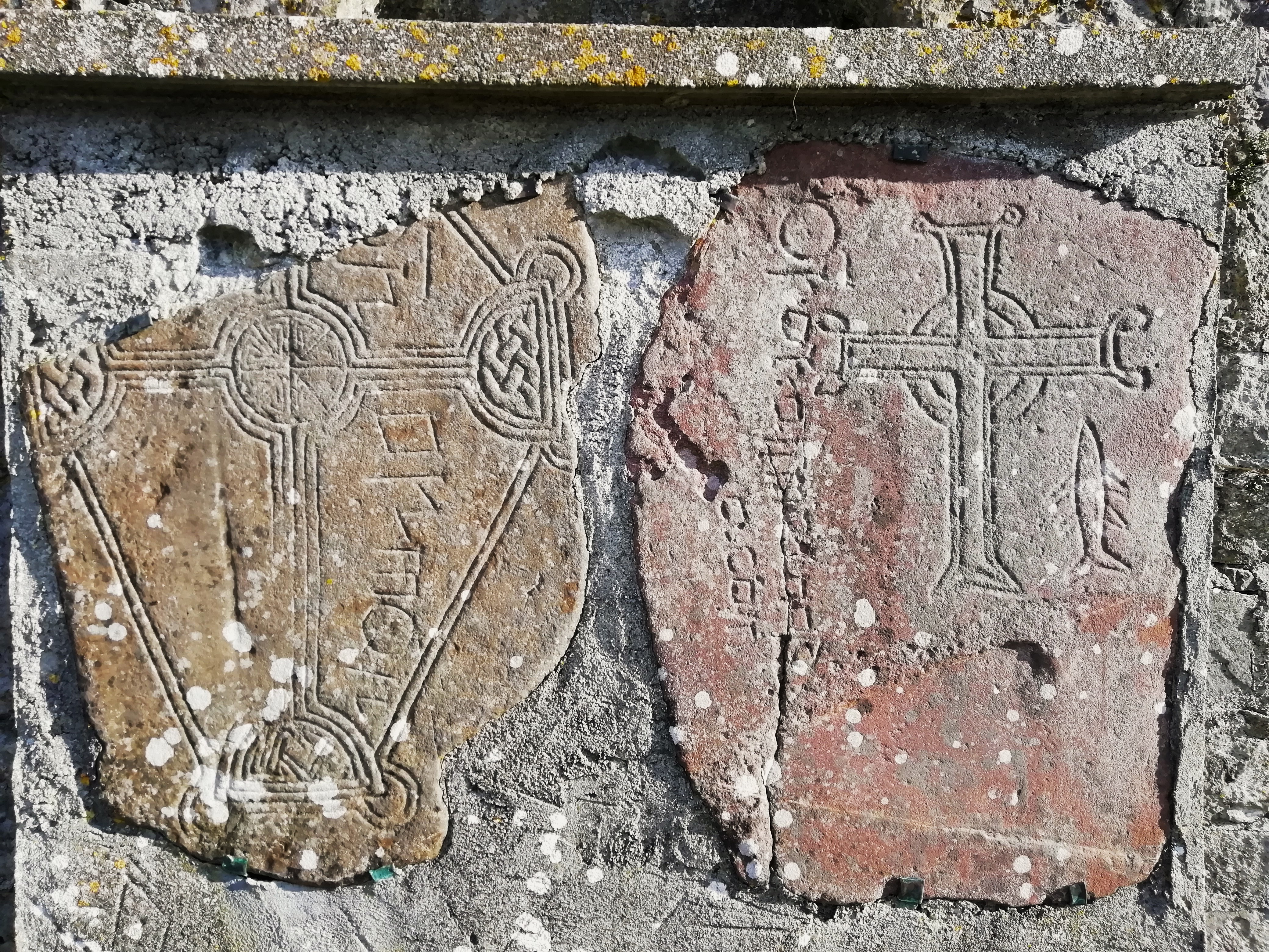
The Christian Cross Slabs at Fuerty have been inserted into the wall of the Church Belltower. They are reputed to date from the 8th Century and are of Sandstone.

Fuerty Ancient Abbey and Church ruin, Roscommon 

I believe there is another Cross Slab used as a Gravemarker but I didn't spot it on my visit. There is also another Cross fragment from Fuerty housed in the National Museum.

Fuerty Ancient Abbey and Church ruin, Roscommon

One of the slabs is also adorned with a delightful carving of a fish which is unusual to see on early Irish Cross slabs. Presumably this carving of a fish is a representative of Christian iconography. It was hugely engaging in its simplicity.

Fuerty Cross Slabs

Partial inscriptions in Irish are also visible on the Slabs.

Old Post and Telegraph Phonebox, Castlecoote, Roscommon

Not far from Fuerty and about 2.5 km along the R366 is Castlecoote where I came across an old Department of Posts and Telegraphs Phonebox.

Old Post and Telegraph Phonebox, Castlecoote, Roscommon 

It had some clippings about the area posted inside it, a nice touch. There was a Garage here beside the River Suck where I grabbed an Ice Cream cone.

River Suck, Roscommon, Ireland

I also came across a link to Castlecoote Georgian House 
of which at the time of writing I know very little.

-------------------------------------------------


 This fascinating article;
 

by vox hiberionacum  
goes into great detail on Fuerty, the Saints and Deacon Iostus. 

The basic thread of the article is about the differing contemporary interpretations of historic events and societal structures versus actual historical reality on the ground at the time the events occured. 

It's a recurring theme in the modern interpretation and retelling of ancient historical figures and texts whether they be mythological warriors or Saintly men and women. Sometimes it is difficult to taste whether the soup has had a pinch of Salt added or not.   

------------------------------------------------

There is a very good article linked below (open access) at JSTOR entitled ; 

On Two Inscribed Stones at Fuerty.


It has some interesting information pertaining to the Fuerty Cross Slabs.
--------------------------
Fuerty Cross Slabs texts

-----------------------------
---------------------

Fuerty Cross Slabs

------------------
--------------------

Fuerty Cross Slabs texts

---------------------
----------------------------------

An old King Edward the 7th 
(ER VII) Postbox/Wallbox 
across the road from the Church at Fuerty.

Edward VII Postbox, Fuerty, Roscommon

Fuerty Abbey, Church and Ancient Graveyard.

Fuerty Ancient Abbey and Church ruin, Roscommon

Fuerty Ancient Abbey Signage


Fuerty Ancient Abbey and Church ruin, Roscommon

Fuerty Ancient Abbey and Church ruin, Roscommon

Fuerty Ancient Abbey and Church ruin, Roscommon

Fuerty Ancient Abbey and Church ruin, Roscommon

Below is an old roadside Milepost/Milestone opposite the Church. This one is marked Dublin 71 miles but it is much weathered and faded. 

These generally date from the 1700 and 1800's and indicated distances to major cities, towns and villages. There are not many left standing "in Situ" today so its always nice to come across one when travelling.

I always think of horses and Coach drawn carriages when I see them and am probably overly romanticizing them but they are nice to see dotted here and there about the countryside nonetheless. 

Fuerty, Milepost, Roscommon, Ireland

Fuerty, Milepost, Roscommon, Ireland

The large Mill Wheel below is also located directly across from the Church ruins at Fuerty. It has been repurposed and put to good use in this instance. Nice.

Fuerty, Roscommon, Mill Wheel

Fuerty, Roscommon, Mill Wheel

The ruin pictured below is on the road from Fuerty going towards Castlecoote, the R366. I couldn't find any information on it so I'm unsure as to exactly what it once was. Was it a Church, Coach House, Blacksmiths ? 

I've really no idea however it's a substantial building of well constructed cut stone.


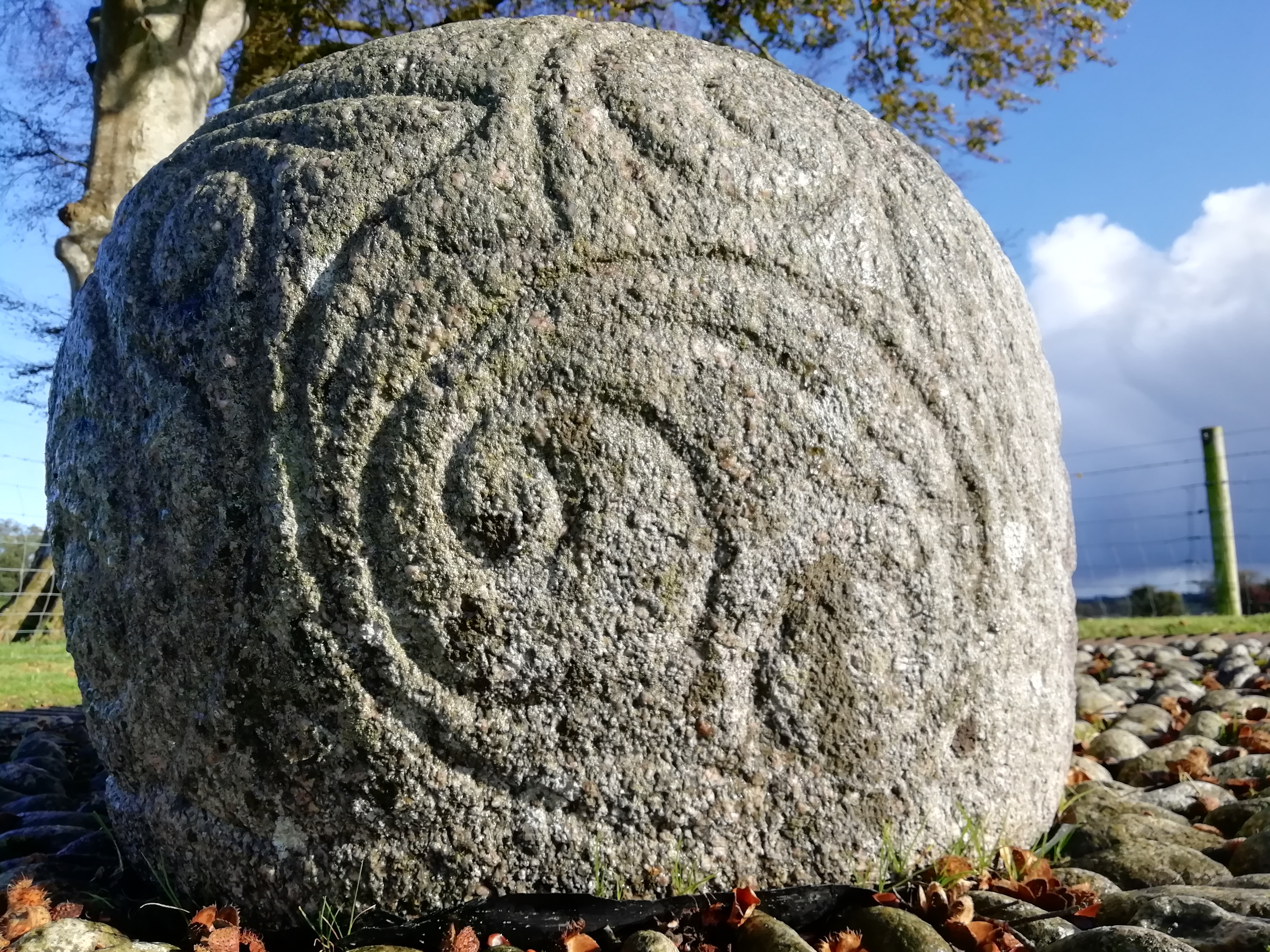
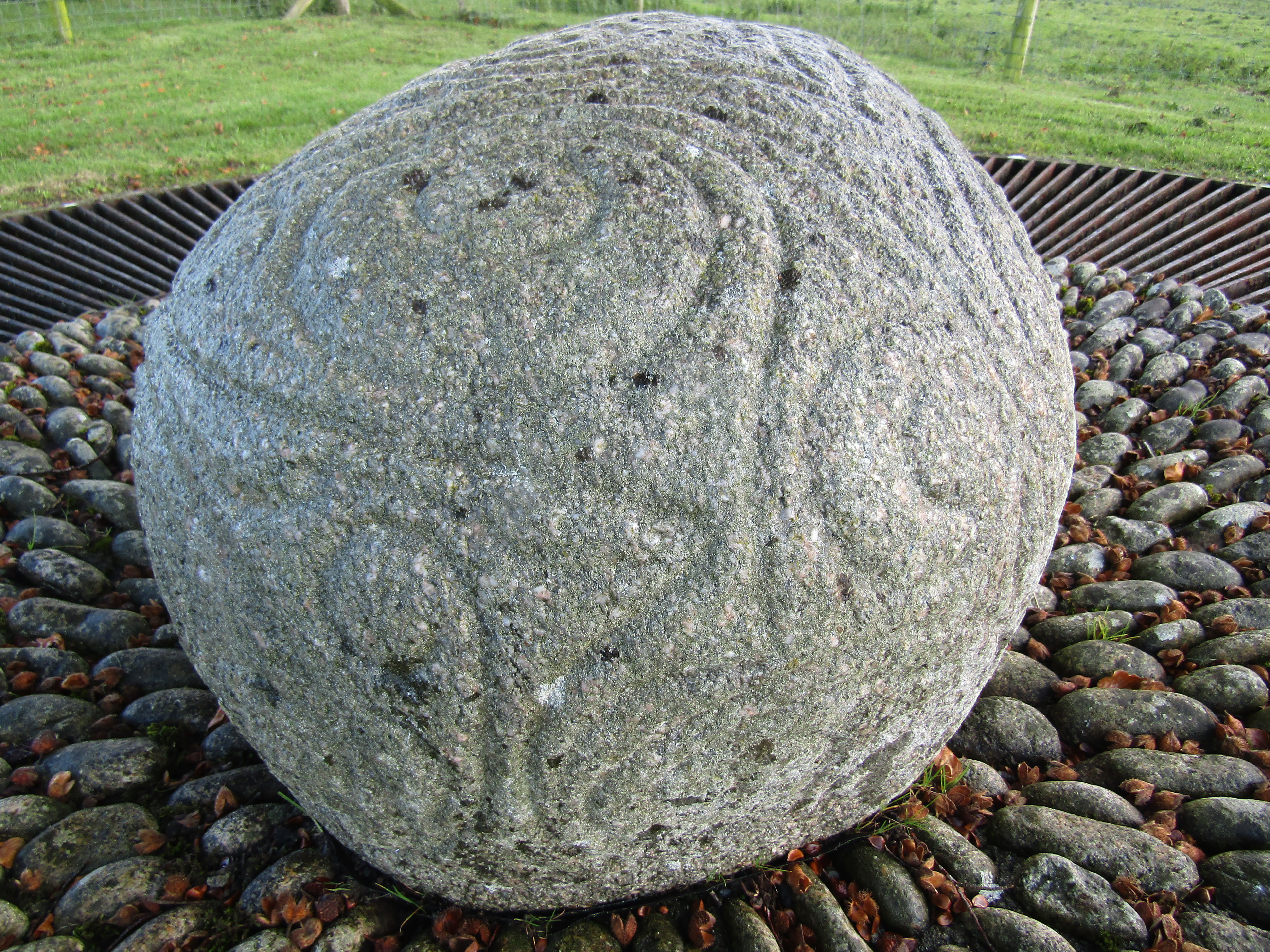
Pictured lastly is one of the very few La Téne stones in Ireland, the Castlestrange stone.

There are just three examples of these in the Country. The aforementioned Castlestrange, the Kilcluggin and the Truroe Stones.

These stones are believed to have Celtic influences and are dated to the Iron age. I am including Castlestrange as it is near Fuerty and was in fact where I was headed when I initailly came across the Fuerty Cross Slabs.

Castlestrange La téne stone

Castlestrange La téne stone

Castlestrange La téne stone

Further reading : 


Coordinates here :

53°36'37.3"N 8°16'07.2"W

53.610356, -8.268671


Keep the wheels turning.....