Milestones
There's a seldom seen reminder of the past that is often overlooked while more often than not it is in plain sight. These are Milestones, sometimes called Mileposts or Mile Markers.
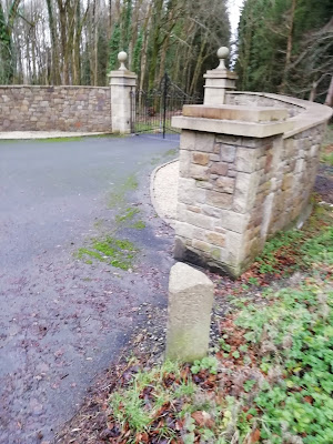
The one below is at Clonbullogue in Offaly and says on one side Dublin 40, and on the other, Port 9. It's believed to date to some time around 1830.
Milestones predate the era of the Car or Bus. They would have been very important to someone travelling on Horseback or on a horse drawn Carriage. Perhaps even those walking on foot might have found them useful.
The Milestone below says Birr 7.2 on one side and Mt Melick 14 (Mountmellick) on the other side.
It's located near Kinnity in Offaly and is dated to 1770.
The stones are almost like a type of early signpost for traffic.
While today there are lots of road signs and plenty of Petrol Stations it would have been very important when travelling by horse to be able to accurately tell the distance to the next Town or to a far off City.
The Milestone below is in the Graveyard of the old ruined Church at Oughval on the Windy Gap in Laois.
It references Dublin, Nenagh and Roscrea and is possibly a modern reproduction used as a Grave Marker.
I don't know when they became popular and widespread but certainly there were plenty by the 1700's and probably earlier too.
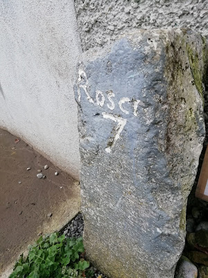
The Milestone below references Roscrea at 7 miles. It is located at Dunkerrin in Offaly.
It is also near the Homestead of Irishwoman Kate Shelley who became a heroine in Iowa in the U.S.A. and had a Locomotive and a Bridge named after her.
Milestones are easily overlooked and forgotten about yet there is a simple pleasure to be found in looking at them.
Whenever I see one I try to read and decipher the inscription on it. They usually state the distance to another specific place such as a large Village, Town or City.
The Milestone below is at Fuerty in Roscommon and dates to 1780. It was not possible to make out the well worn inscription.
Some may also have what is called a Benchmark, Crows Foot or Sapper's Mark carved on them. This is a mark normally used to describe the point above Sea Level at the mark.
This Milestone below is at Aughrim in Galway. The area was also the site of the Battle of Aughrim which was the decisive battle between Williamite and Jacobite forces in Ireland.
The Jacobite leader, Frenchman Charles Saint-Ruth had his head cleaved off by a Cannonball and in the subsequent confusion the superior Jacobite forces were routed by the Williamites and history was written.
A Milestone at Borrisoleigh in Tipperary indicating the distance to Templemore as 5 miles and 3 furlongs. This Milestone was originally a Guard stone/Jostle stone designed to protect a building from a passing horse and carriage wheel.
Below is what is listed on the NIAH as a Milestone but is also called a County Boundary Stone. It is inscribed "Queens County 1763".
I didn't see any distances marked on it. Queen's County was the old name for Laois, named for Queen (Bloody) Mary.
I don't know why the National Inventory has it listed as a Milestone but perhaps that was its original function.
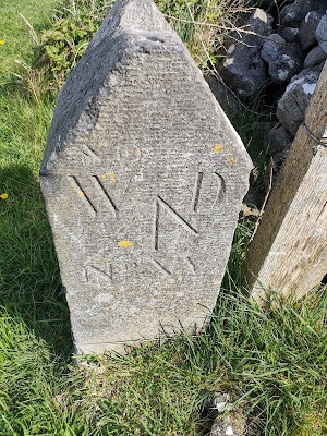
The Marker below is a War Department Stone at Finvarra in County Clare marked WD XIII. It is near a British Martello Tower c.1810.
I had initially confused it with a Milestone however I believe War Department Stones like the stone below were used to delineate the boundary of military sites.
Keep the wheels turning....


.jpg)
.jpg)
.jpg)
.jpg)
