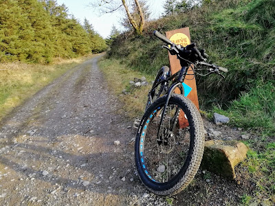
Coillte ,the forestry managment agency, have opened their new midlands based Coillte Mountain Bike Trails - Slieve Bloom Mountain Bike Trails.
Based in Laois and Offaly the MTB trails introduced so far are a Red trail in Laois and a Blue trail in Offaly.
This post focuses on the Blue trail which is designated as "moderate" and begins and ends in the village of Kinnity in Offaly.
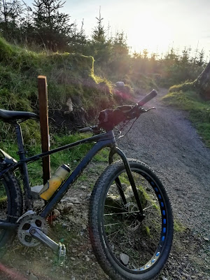
Having ridden it twice I found it nice and fast and twisty. There is nothing too technical so it's suitable for just about everyone. The only difficulty encountered will relate to speed.
Obviously enough the faster you descend the more difficult it becomes which basically means that if you are just starting out take things slow and get the hang of descending and maneuvering.You don't want to wrap yourself around a tree starting out and there's no need to do so either.
You won't encounter any major obstacles so the Blue course is suitable for those who want to try MTB trails for the first time (going carefully) or more experienced riders who are after a bit of speed going downhill.
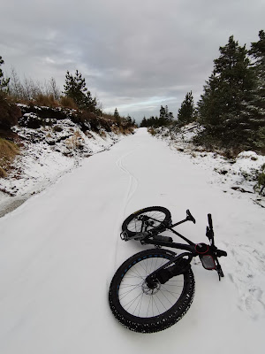
Full suspension, No suspension, Hard tails, CX bikes, Adventure bikes, Fat and semi Fat. Anything with a reasonably wide tyre will get you around one way or the other.
There's no need to be rushing out for expensive equipment or expensive bikes to be able to enjoy this facility. About the only bike I wouldn't dream of using here is a road style racing bike with thin wheels or a unicycle. After that I think anything goes.
There are two loops to the top of the Blue route with the longer route being roughly 12 Kms for the full loop. The climbing is chiefly on wide forest trails and requires a small bit of effort but the effort is well worth it.
It's an ideal family venue and a great place for children and big children alike to enjoy their bicycles and their cycling.
This post is mainly aimed at alerting readers to the heritage and history of the immediate area which is close to Kinnity and that can be reached from there easily by bicycle. If you get tired of the MTB trails there's plenty to see and do hidden away in the local area, especially if you like the somewhat small and obscure.
Cadamstown Coordinates :
53°07'36.3"N 7°39'42.5"W 53.126745, -7.661815
Cadamstown is a small village not far from Kinnity. It lies on the Silver river. There is a delightful little riverside walk in the village which will take you down by the old mill which has several pieces of old equipment associated with the mill lying beside it. There are also several small gorges here which cut through the predominant sandstone of the Slieve Bloom area and are very picturesque.
Behind the mill is a forest walk and a modern contemporary "Dolmen" structure. It was erected in 2006 in memory of Charles Carroll, a signatory of the American Declaration of Independence. The village was once known as Ballymacadam.
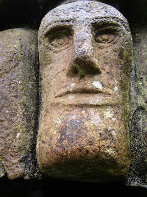
Saint Luna's Roman Catholic church in the village has three early stone carvings embedded in the front facade which are from the nearby Saint Luna's Holy Well and Monastery at Letter (Leiter). You will have to look carefully to spot them, one is a carved head, another is believed to be a fragment from an arch or column, while the third is a cross slab. All are from the ancient church at Letter.
If you're quiet and it's sunny you might sit by the riverbank and watch as Dippers literally use their wings like paddles and swim under the clear water in search of insects. For sore muscles find a nice deep pool and relax in the clear fresh water for a few minutes.
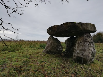
The Giants Grave is signposted from Cadamstown and is the remains of a type of early prehistoric burial structure, either a Portal tomb (Dolmen) or perhaps a Bronze age Cist. It was looted centuries ago in the forlorn search for buried treasure and all that remains now are the fallen stones of the original prehistoric structure.
Not far from Cadamstown and signposted is Saint Luna's (Letter- Leiter) monastic settlement. This is a rough road and the land around Letter is marshy at times.
Letter monastic site Coordinates :
53°07'06.9"N 7°39'21.5"W 53.118573, -7.655961
At Letter is Saint Luna's Holy Well and the remains of an ancient monastery, of which all that remains standing are parts of its walls.
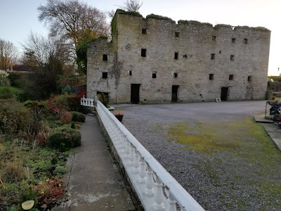
It is nonetheless a beautiful and tranquil area on the edge of the mountains. There is an old 17th century building opposite the ruins and Holy Well. This early christian site is believed to have been established sometime in the 6th century by Saint Luna.
The monastic site of Seir Kieran is not far from Kinnity (about 10 Kms) and lies in the small village of Clareen.
Seir Kieran Coordinates :
53°04'14.1"N 7°47'35.6"W 53.070591, -7.793220
Established some time in the 5th century this quiet and secluded ancient site was founded by "the first born of the Saints of Ireland," Ciarán of Saighar. There is the remains of a round tower, the base of a High Cross, a Holy Well, and the remains of a 17th century fortification on the site alongside the more recent c. 1780 Saint Kieran's Church of Ireland.
A large mound is clearly visible from the site and this would have been a "Motte" on which a wooden Norman castle would once have stood surrounded by a defensive fenced enclosure, the "bailey."
Approximately 20 Kms from Kinnity is the town of Birr. Once known as Parsonstown, Birr is home to a large castle which houses what was in the 1840's the largest telescope in the World built by the third Earl of Rosse.
Birr Coordinates :
53°05'43.8"N 7°54'30.8"W 53.095491, -7.908553
The town also houses a "Greek Temple" style building which was used for local authority business and there is a Crimean War Cannon from 1855 in front of the building alongside "Umbilicus Hiberniae," the Navel of Ireland, also known as the Seefin Stone. A statue of the Earl of Rosse stands nearby.
The town is full of early buildings and architecture including several churchs and an old monastery. Birr was also the site of the worlds first automobile fatality.
Crinkle Coordinates :
53°04'43.1"N 7°53'41.6"W 53.078633, -7.894895
Near Birr is the small village of Crinkle and the walls of its barracks which were burned down during fighting in the Irish civil war. There is a small memorial in Crinkle to the soldiers of The Prince of Wales, Leinster Regiment, Royal Canadians. Very little remains of the barracks which was occupied at various times by both Pro and Anti treaty forces before it was burned.
Leap Castle lies roughly 16 Kms from Kinnity. The castle is in private ownership and tours are available. One of the fascinating aspects of Leap Castle is that it has not been fully restored nor has it been over restored so it actually feels like a genuine "old castle."
Leap Castle Coordinates :
53°01'40.5"N 7°48'33.1"W 53.027924, -7.809206
It has featured on several television programs and is reputedly Ireland's most haunted castle though I can't say I noticed anything "haunting" the halls myself. It is well worth a visit but phone in advance to check opening times. The owner Sean Ryan is quite a storyteller.
Kinnity castle obviously enough in Kinnity itself, was once called Castle Bernard. Begun in 1820 it is described as "Tudor style Gothic Revival."
There is a partial High Cross and font in front of the building and several beautiful sculpted figures line the entrance carved into wood stumps.
There are many interesting woodland walks and various old buildings dotted throughout the grounds of Kinnity Castle.
In the village of Kinnity the Bernard family mausoleum is designed as a small pyramid. It is located at the rear of Saint Finnians Church of Ireland. Inside the church is an early inscribed Christian Pillar slab, possible once used as a tomb slab. No one is sure of its original function.
Saint Flannans Roman Catholic Church in the village dates from 1820.
Cumber Holy Well and Bullaun Coordinates :
53°04'27.6"N 7°41'51.4"W 53.074320, -7.697621
For those willing to head for the more obscure local heritage Cumber/Forelacka has a Holy well with a large Bullaun Stone beside it.
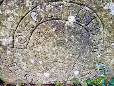
The Bullaun Stone has two deep depressions in it. Bullauns in prehistory were probably vessels used for grinding grains however most are now associated with religious sites, perhaps used as fonts or for holding water which was blessed.
It's not far from Kinnity to Cumber, a little under 4 Kms. The road here is a dead end into private property but follow it until it ends at a farm gate and you will see a small raised mound here. This mound is believed to be an early Bronze Age burial mound.
It has not been archaeologically investigated as far as I am aware and may contain a Cist style burial chamber.
Glenafelly is further on from this area, go back the way you came and go left at the junction this time following the road signs for the Slieve Bloom mountains. In Glenafelly is a forest recreation area and the Fiddlers Rock, a large standing stone which lies in a field opposite the forest recreation parking area.
This stone is made of quartzite which is rare in the Slieve Blooms. It may have been carried here over 10,000 years ago as a glacial "erratic."
Glenafelly "Fiddlers Rock" Coordinates :
53°03'44.3"N 7°42'00.5"W 53.062313 -7.700128
Presumably human intervention perched it uptight where it still remains today.
There's a lot more hidden around the hills of the Slieve Bloom mountains and scattered throughout Laois and Offaly. Enjoy your cycling and the tranquil midlands. I'll do a post on Laois and the Red trail when I get a chance to cycle it. I hope the information was of some use to you and thanks for reading.....
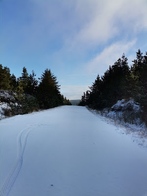
Below are just a few photographs from around the Slieve Bloom mountains on the Laois side.
