Monday, 6 July 2020

Kells Priory, Kilkenny

Kells Priory

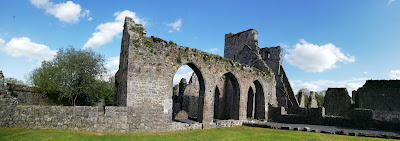
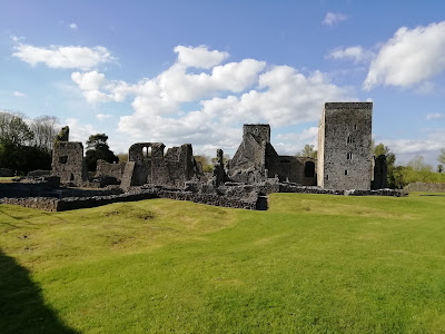
Kells Priory is a sprawling late 12th century monastic site under the care of the OPW in County Kilkenny. Access is free and the site is open year round to visitors.

Kells Priory

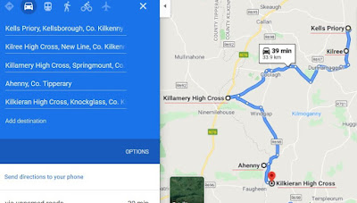
It's possible to visit Kells Priory and a grouping of early Christian sites which includes many High Crosses of the "Ossory Group" in a short journey of about 40 Kms in total (one way).

Kells Priory

The sites which include the "Ossory" High Crosses are also free of charge to visit and include Kilree, Killamery, Ahenny and Kilkieran.

 Kells Priory

A journey which included visiting all sites and sightseeing can be done in a day and would include Kells Priory itself, a Round Tower and High Cross at Kilree, 6 further High Crosses, a Standing stone, Holed stones, Bullaun stones, Holy Wells, and a staggering variety of early relics and beautiful countryside, all within a "Stones throw" of each other.

 Kells Priory

This post in about the first stop, Kells Priory. I'll include a screenshot of a possible route and the locations and their coordinates and later I'll add some posts to cover the other sites and update links to them as well.

 Kells Priory

The Augustinian Priory at Kells was founded by an Anglo Norman Knight in 1193, Geoffrey FitzRobert
(de Monte Morisco).
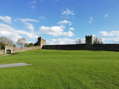
It is an extensive and well fortified settlement with foreboding walls and towers and a protected gateway through which you enter the inner enclosure.

Kells Priory

The enclosure with its surrounding walls and towers looks more like a large Castle bawn wall. I can only presume that the Norman's were under pressure in the area when the Priory was established because of the heavy fortifications throughout the site.

Kells Priory

It was attacked several times throughout its history including one attack by Edward (de) Bruce, brother of Scottish Independance hero, Robert.
Edward was defeated, decapitated, dismembered and buried at Faughart Hill, Louth. He had at one stage declared himself High King of Ireland, a position that ultimately he didn't hold for long.

 Kells Priory

The church ruins and the many ecclesiastical buildings on the site are a real pleasure to wander around.
The Priory was "dissolved" in 1540 during the "Dissolution of the Monasteries"
under Henry (Tudor) VIII during the Reformation.

Kells Priory

The dissolutions provided Henry with enormous wealth as the monasteries and their lands, property and valuables were confiscated and he could use the money from the sale of the former monastic lands and valuables to fund his wars and loyal nobles.

Kells Priory

A huge repository of historic documents and manuscripts were probably destroyed forever however one legacy of the Reformation has been the wonderful ruins at Kells Priory and the saying that " a Country without ruins is a Country without history".

Kells Priory

There is also an association with the attempt at trial for heresy of Alice Kytler in 1324 at Kilkenny. 
Alice was well connected and fled the country, while in typical fashion her unfortunate Maidservant was instead tried and burnt as a witch in her place.

The Bishop who oversaw the matter, one Richard de Ledrede visited here as he travelled to oversee the investigations into Witchery at Kilkenny.
It is reputedly the first instance of a person burned for Witchcraft in Ireland.
Kilkenny Hurlers take note.....


Kells Priory

 Map screenshot and the coordinates for the various locations are listed at the bottom of this page and I'll post information on the other sites at a later date.

Kells Priory

I can only add that there are few better ways to spend a day and take in so much while not an entrance Fee in sight !

Kells Priory

Kells Priory

Ossory High Cross


Coordinates :


Kells Priory : 52°32'11.7"N 7°16'05.8"W 

52.536587 - 7.268270


Kilree Round Tower and High Cross : 52°31'05.1"N 7°16'03.6"W 

52.518074 - 7.267663

Kilree Round Tower and High Cross 


Killamery High Cross : 52°28'34.8"N 7°26'39.4"W

52.476328 - 7.444272

Killamery High Cross 


Ahenny High Crosses : 52°24'46.2"N 7°23'39.7"W

52.412825 - 7.394346


Kilkieran High Crosses : 52°23'54.6"N 7°22'47.0"W

52.398503 - 7.379707

*** The sites listed as "High Cross" also contain many other relics and items of historical interest.

A large area of Laois, Kilkenny and Tipperary were originally part of an area known as the 
Kingdom of Ossory.
 
Ger Dooley goes into greater detail on Ossory at the link below.


Ger Dooley - The Kingdoms of Ossory 


Thursday, 2 July 2020

Seefin Passage Tomb, Wicklow

In County Wicklow close to the Dublin border lies Seefin Passage Tomb.

Seefin Passage Tomb, Passage

At one time it was little known and seldom visited but with the rise in outdoor activities and Hill walking it has seen a lot more visitors over recent decades.

Seefin is in a class of archaeological monuments known as Passage Tombs, its better know relations being Newgrange in Meath and Loughcrew.

Seefin Passage Tomb, Cairn

Seefin Passage Tomb can only be accessed by walking cross country and uphill for about 20 minutes and it isn't on any tourist trail. 
Hiking boots are recommended.

Seefin Passage Tomb, Cairn

Unlike Newgrange, Knowth and Dowth, Seefin lacks detailed intricate Rock Art however its location, and weather permitting, views across the countryside from its mountaintop location more than make up for this. 

It is stated in various places that there are small amounts of Rock Art here however I haven't seen it myself so perhaps I just need to look closer.

Seefin Passage Tomb, Cairn

On the hilltop next to Seefin is Seefingan which also has a large Passage Tomb on it but it has never been excavated or breached so its secrets still lie buried within it until such time as archaeologists investigate it.

Seefin Passage Tomb, Chambers

Irelands Neolithic period 
(stone age) 
is generally given as 4500 to 2500 B.C. so Seefin is at least 4500 years old and perhaps older with 6500 years ago being taken as the start of Ireland's Neolithic era.

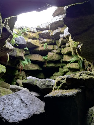
To enter the Passage tomb at Seefin you can either crawl through the passage itself or drop down through the hole in the damaged roof. 
Normally I would advise against climbing onto the tomb cairns however the roof at Seefin has been opened up to the elements.

Seefin Passage Tomb, Cairn

The passage leads to the inner chamber which has five side chambers, some damaged. There were never valuables in Passage tombs during Neolithic times. 
Initially only cremated human bones were buried inside them. These remains were placed onto large urns/bowls and housed in the side chambers.

Seefin Passage Tomb, Entrance

No remains were found at Seefin when it was investigated so it could have been previously raided in a misguided search for booty or loot. Perhaps the people moved out of the area and took the remains of their dead with them, we will never know for sure. 

Seefin Passage Tomb, Chamber

Early archaeological investigations of Passage Tombs were often hurried and destructive affairs as those who were excavating were usually in a hurry and hoping to find valuables such as Gold or precious stones, perhaps carved or ground into jewellery however nothing but cremated human bones were ever buried in Passage Tombs by Neolithic peoples.

Occasionally there were finds of carved animal bones, broken pottery and small beads in Passage Tombs but nothing that would swell a Raiders bank balance.

Seefin Passage Tomb, Corbelled Roof

It does seem however that later cultures reusing the Passage Tombs possibly added things into their burials as votive offerings such as fancy beads and jewellery. Roman coins have also been found at Newgrange and Passage Tombs were reused and utilised even in the Iron age.

The huge flat stones used for roof corbels would originally have been picked, sorted, and carefully positioned while the many stones used to build the cairn all had to be moved by hand. 

All this was done without machinery and on the top of a mountain as well. Quite a feat of craftmanship and engineering. When they were sealed up these tombs remained perfectly dry for thousands of years.

Who were the people who built these monuments to their dead, where did they come from, and why did they put such a huge effort into building these Stone age Passage Tombs?

We can but wonder and look at them in awe..........

Coordinates here :
53°11'10.8"N 6°23'40.8"W
53.186330 - 6.394656


Monday, 8 June 2020

Saint Fintans Well, Laois

Cromogue in Laois is about 3 or 4 Kms from Shanahoe which itself is not far from Abbeyleix.

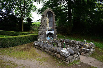
Saint Fintans Well, Cromogue, Laois.

It's a very rural, quiet and tranquil spot and the Holy Well here is carefully maintained and looked after. 

Saint Fintans Well, Cromogue, Laois.

Saint Fintan is closely associated with Clonenagh near Mountrath where he is reputed to have established a Monastery in 548.

Saint Fintans Well, Cromogue, Laois.

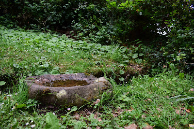
There's a nice little Bullaun Stone by a little stream which runs from the site and the water in the Well is very clear and looks like it is coming straight up from a spring.

Saint Fintans Well, Cromogue, Laois.

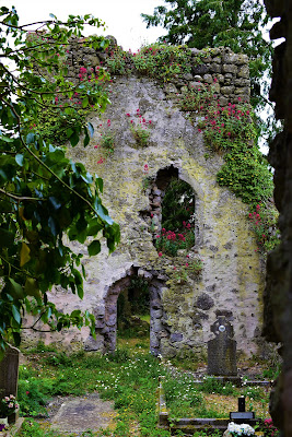
There is a nearby early medieval church ruin which is belived to have originally been constructed in the 12th Century although most of the present church would be of a later date. 

Saint Fintans Well, Cromogue, Laois.

The church is dedicated to Saint Fintan and it's understood that an ancient road or Togher once ran from here to the Monastery at Clonenagh near Mountrath.

Saint Fintans Well, Cromogue, Laois.

The doorway into the church is believed to date from the 12th Century and beside it is the ruin of a tower. A lot of the headstones in the graveyard date from the 1700's.

Saint Fintans Well, Cromogue, Laois.

It's believed that Saint Fintan lived at Cromogue before he left and established his Monastery at Clonenagh.

Saint Fintans Well, Cromogue, Laois.

Saint Fintan's feast day falls on 17th February and although I'm not sure I believe that services or worship are held here on that day.

Saint Fintans Well, Cromogue, Laois.

The roads to Cromogue are small and rural and very quiet, perfect for a cycle on a nice summers day. The name is often spelled both Cromogue and Cromoge on maps.

There was also a Well dedicated to Saint Fintan at Clonenagh and another at Durrow in Laois. The Well at Clonenagh dried up and at Durrow I couldn't locate it although it may be there somewhere under loose vegetation.

Coordinates here:

52°57'27.4"N 7°24'54.4"W
52.957618, -7.415098

Saint Fintans Well, Cromogue, Laois.


Thursday, 4 June 2020

Clonmore, Carlow

Hidden away in county Carlow is the tiny hamlet of Clonmore which was an important early Christian site. 

It's about 17 Kms from Tullow or 30 Kms from Carlow town and a wonderful place to visit, full of natural beauty and tranquility.

Clonmore

What I really like about places like Clonmore is that more often than not they aren't awash with crowds of visitors so they are really peaceful places to visit. 

Clonmore

No queues, no entry fees, no crowds and no traffic jams, just nature and the historical environment. 
Often you come across places like this quite by accident just wandering around in rural Ireland.

Clonmore

In the 6th Century Saint Mogue (Maedoc) founded a Monastery here and the remains and evidence of a strong ecclesiastical tradition are to be found throughout the area.

Clonmore

I spent a couple of hours in this tiny area but if time had permitted I could have relaxed here for the day enjoying the sights and sounds around me.

Clonmore

Saint Mogue's High Cross is a large undecorated granite High Cross situated in the grounds of Saint Mogue's Church of Ireland.

Clonmore

There is a huge Bullaun stone by the bridge over the stream which runs through Clonmore and it was probably moved to its present location from the nearby fields. There are three big depressions in the Bullaun and a smaller fourth depression in it as well.

Clonmore

The Cemetery contains a huge amount of Christian Cross Slabs, both recumbent and upright. 
I think these Cross Slabs may probably date from the mid Christian to late medieval period but not being an expert I can't be sure of the dates for them.

Clonmore

One stone in particular has a date from the 1800's marked on it and several words in Irish as well as many unusual markings which actually looked a little like Bronze Age cup and ring marks although I have no idea what those markings actually are and they are not recorded as such.

Clonmore

There is also the head of a huge High Cross included in a group of Slabs gathered together and the cross it came from must have been very large and impressive when it was originally in one piece. 

Clonmore

A lot of the smaller Cross Slabs at Clonmore are very similar to Cross Slabs I have seen in Ballymore Eustace and other areas in Wicklow and Carlow.

Clonmore

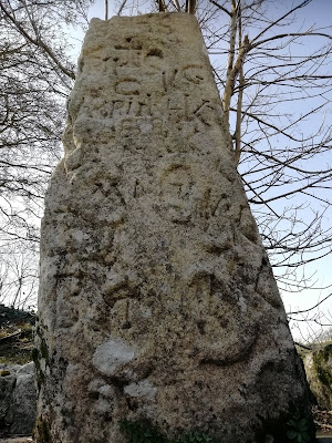
There's an Ogham Stone here as well, pictured above. Ogham was an old Irish 20 letter alphabet originating around c. 350 AD and consisted of groups of linear slash marks. 

It's chiefly found in Ireland but also in parts of Britain and very occasionally uses other languages other than old Irish or Gaelic.

The Ogham inscription on the stone isn't visible any more and has now been worn away, or at the least my eyes couldn't make it out if it's still on the stone.

Clonmore

There are several bits and pieces of ancient masonry work scattered around the site and something which looked like a water trough though probably isn't, yet still very interesting to look at. 

Clonmore

There's also an upright Grave Stone which looks like it's made from Schist and has a hole in the middle worn or cut through it and I couldn't but wonder did it have an association with a later local tradition of some sort.

Clonmore

There's a beautifully maintained little Well, Saint Mogue's Holy Well and a small pond and manicured grassy area which are really nice to relax at beside the Church.

Clonmore

Clonmore Castle is nearby and a 2 minute walk from the Church. It is a large Anglo Norman Castle ruin mooted as originally dating from the 12th or 13th Cty with some later modifications.

Clonmore

I don't know a huge amount about Castles so I'll leave it's dating to the experts. I believe there are no records of it's initial construction. The structure would have been quite compex and has numerous, in technical parlance, "Snazzy" windows so it looks too well designed to be a 12th Cty construction although they could have been added later I suppose.

The Castle would benefit from conservation work to ensure no further damage is caused by the elements and weathering. 

It would be nice to think it would still be there a century from now rather than it fell down over the intervening years.

Clonmore

As a place to visit, enjoy and explore, Clonmore ranks highly in my book and no doubt when things get going again in 2020 I look forward another visit.

Coordinates to Clonmore : 

52°49'38.2"N 6°34'11.5"W
52.827265, -6.569846

On a side note I've used the term cemetery in this post where really to be true to fashion the preferred reference to a burial place attached to a church is graveyard. Likewise I often use Portal Dolmen when the proper usage is Portal Tomb....Hopefully it's not a hanging offence.
Keep the wheels turning.