Sunday, 17 December 2023

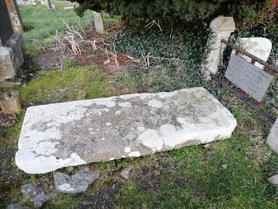
Kilmacduagh Monastic Settlement, Gort, Galway

 Kilmacduagh Monastic Settlement


Kilmacduagh, Galway

The town of Gort in Galway lies roughly in the southwesterly portion of the County and from here you can meander down through the Burren and into County Clare on your travels.

Kilmacduagh, Galway

Just outside Gort is a wonderful collection of ancient buildings of which I had known very little and never heard tell of before.

Kilmacduagh, Galway

I was quite surprised to come across what in reality turned out to be a substantial and important ancient monastic settlement replete with Ireland's tallest Round Tower.

Kilmacduagh, Galway

At the time of my visit I didn't get to fully explore the area nor find out its full history as some of the buildings were closed up.

Kilmacduagh, Galway 

A monastery was founded here by Saint Colman who was a son of Duagh, hence Kilmacduagh or in English, The Church of the son of Duagh.

Kilmacduagh, Galway

The Round Tower leans slightly to one side and there are several small Churches dotted about the site along with some other ecclesiastical buildings.

Kilmacduagh, Galway

After the Anglo Norman conquest of Ireland which began c. 1169 the established continental religious orders flourished throughout Ireland and Kilmacduagh became an Abbey of an Agustinian order sometime in the 13th Century.

Kilmacduagh, Galway

The scale of the site amply demonstrates the importance it must once have held and it's quite likely it would once have rivaled both Clonmacnoise and Glendalough in significance.

Kilmacduagh, Galway

Unfortunately my visit was all too fleeting so although I'm determined to return in the immediate future I would highly recommend to anyone reading this post to mark it as a fantastic site to visit.

Kilmacduagh, Galway

I would also suggest bringing a picnic basket along with you too as there were several benches dotted about.

Kilmacduagh, Galway

Not far from Gort is also to be found a one time home of W.B Yeats, Thoor Ballylee, an Irish Tower House.

Kilmacduagh, Galway 

 Keep the wheels turning.

Kilmacduagh, Galway

Coordinates here :

53°02'50.7"N 8°53'14.0"W


Kilmacduagh, Galway

Further Reading :

Kilmacduagh, Galway

Monastic.ie - Kilmacduagh

The Lady Gregory and Yeats Heritage Trail

This is Galway _ Kilmacduagh Round Tower

Kilmacduagh, Galway

Kilmacduagh, Galway

Kilmacduagh, Galway

Kilmacduagh, Galway

Kilmacduagh, Galway

Kilmacduagh, Galway

Kilmacduagh, Galway


Kilmacduagh, Galway


Thursday, 9 November 2023

Lea Castle, Portarlington

 Lea Castle

Portarlington


Lea Castle in Portarlington was possibly constructed under the direction of William Marshal in the early 13th century.

Lea Castle, Portarlington 

It was probably preceded by an earlier Motte and Baily type fortification, a large mound and encircling earth banking with a wooden structure on top of the mound.

Lea Castle, Portarlington

It is one of a few early Anglo Norman stone built Castles still standing in Ireland .

Edward Bruce Grave

Edward Bruce, a brother of the Scottish King Robert the Bruce and a one time claimant of Kingship of all Ireland burned the Castle in 1315 but it wasn't destroyed totally and passed into other hands as time progressed.

Edward Bruce Grave


 Edward is buried, minus his head, on the Hill of Faughart in County Louth.

Lea Castle, Portarlington

The Castle has been associated with many different families throughout its chequered history passing back and forth continually.

Lea Castle, Portarlington

Roughly two thirds of the Castle was blown up c. 1650 and it had been destroyed, partially destroyed and rebuilt several times in the previous centuries.

Lea Castle, Portarlington

I've just a few photographs of the Castle posted here but with such substantial remains still "in situ" it's unfortunate the local authority haven't taken more of an interest in restoring it.

Lea Castle, Portarlington

I think geographically it lies just across the County border from Offaly but is in County Laois.

Lea Castle, Portarlington

I'm no expert on Castles but this particular Castle given its age, history and connections appears to me to be a badly neglected yet hugely important historical artifact of national importance.

Lea Castle, Portarlington

Given in lies within the boundaries of Laois it's a piece of neighborhood heritage that would benefit from local government and council intervention to preserve and promote it as a place to visit and open it up to the public.

Lea Castle, Portarlington

Keep the wheels turning

Coordinates here :


Tuesday, 7 November 2023

An Offaly Headache Stone

An Offaly Headache Stone

In the Offaly townlands of Clonsast and Clonshannon lie the sparse ruins of what's believed to have been an early medieval Church. Little remains now other than a few small portions of the walls.

Saint Broghan's, Clonsast, Offaly 

Nearby is also to be found Saint Broghan's Stone, a large single Bullaun stone reputedly used to cure headaches and Saint Broghan's Holy Well.

Saint Broghan's, Clonsast, Offaly

Saint Broghan/Brochan, originally from Scotland, is reputed to have founded a Monastery here in the 7th century.

Saint Broghan's, Clonsast, Offaly 

The Saint is also known as Bearchán, Brachan and Berchán. 

At one time in early Christian Ireland he is believed to have been of major importance though the Saint today is an obscure figure.

Saint Broghan's, Clonsast, Offaly

The Holy Well has a Statue of the Saint in a small enclosure and is very well maintained although it lies across deep muddy fields and may be difficult to access depending upon the time of year you visit.

Saint Broghan's, Clonsast, Offaly

Saint Broghan's Stone is about 800 metres Southsoutheast from the Well. It lies several fields away across boggy wet ground and is difficult to find.

Saint Broghan's, Clonsast, Offaly

It is believed that the Bullaun stone was formed from the impression of Saint Broghan's head. Water would be taken from the Holy Well and placed into the depression on the stone.

Saint Broghan's, Clonsast, Offaly 

A person then placed their head into the water on the stone and divine intervention or a cure for headaches and illness thereof was petitioned for in the hope of intercession.

Saint Broghan's, Clonsast, Offaly

Unfortunately today the stone has cracked across the basin and would no longer hold water. Presumably it has been many years since it was last used as a Headache stone.

Saint Broghan's, Clonsast, Offaly

Despite the stones damage it was nonetheless interesting and somewhat refreshing to see the Well, the Church ruins and the Headache stone all still "in situ" near each other.

Saint Broghan's, Clonsast, Offaly

There is a small Cairn of unknown origin beside the Bullaun and both lie about 100 metres Southeast of the Church remains. There is also a thorn tree (either Haw or Blackthorn) beside the Bullaun called Saint Broghan's Thorn on OSI Historic Mapping.

Saint Broghan's, Clonsast, Offaly

 At one time up to 1500 people gathered here on the Saint's Patten Day and there was also a week long festival. 

Saint Broghan's, Clonsast, Offaly

Apparently the week long festival was eventually abandoned due to outbreaks of alcohol induced happiness which the clergy understandably frowned upon.

Saint Broghan's, Clonsast, Offaly

The nearest village to these sites is Bracknagh with a population of around 200 people. The small 1800's Roman Catholic Church here is called Saint Broghan's Church.

Saint Broghan's, Clonsast, Offaly

Saint Broghan's, Clonsast, Offaly


An ancient road, a Togher/Tochar of gravel, brushwood and sticks once ran from the site in a westerly direction across a bog. It was known as Saint Broghan's road.

Sources and further reading:

jstor.org - Saint Broghan's Road

www.duchas.ie Schools Collection - Saint Broghan's Well

www.duchas.ie School's Collection - The Local Patron saint

Saint Broghan's NS - Our History

Omnium Sanctorum Hiberniae - Saint Berchán

Saint Broghan's, Clonsast, Offaly

Saint Broghan's, Clonsast, Offaly

Saint Broghan's, Clonsast, Offaly

Saint Bochan's Well Co-ordinates here:
53°13'47.8"N 7°08'09.4"W